Fort Worth · 76109
Living in Overton Park, Fort Worth
What to know before you buy or remodel here: the houses, the lots, the park, the schools and the zoning. The median house was built in 1966, on about a third of an acre. Every figure below is a public record, and we say which one.
Or call or text (817) 631-9803
When the houses were built
92.9% of Overton Park’s houses were built between 1941 and 1979.
Here are the build-year counts from the appraisal records, with Tanglewood next door measured the same way for comparison.
Twelve of the 691 single-family parcels here record a build year of 2000 or later, and another 37 record one between 1980 and 1999 — about 7% of the neighborhood since the original build-out ended. Measured the same way, on the same day, Tanglewood’s figures are 59 and 40, about 15%, and five times as many houses since 2000. These are appraisal records rather than permit records, so they are a proxy and not a count.
Both neighborhoods were read from the same parcel set, boundary layer and tax year, on the same day. Tanglewood’s median house dates to 1960, Overton Park’s to 1966.
If you own here or are buying, the useful question is whether the existing floor plan can be remodeled to fit your family, and what that would cost. We can draw it and price it.
- Single-family parcels
- 691
- Median year built
- 1966
- Built between 1941 and 1979
- 92.9%
- Build year of 2000 or later
- 1.7%
Inside the city’s own neighborhood-association outline
Most of it went up between 1955 and 1968, and the last of the original houses went up through the 1970s
Most of the neighborhood. Another 37 houses were built between 1980 and 1999
Twelve houses. Tanglewood’s figure is 8.9%
The park and the trees
Overton Park is built along a city greenbelt of 48.68 acres.
In 1959, the Cassco Land Company deeded the city a strip of land about a mile long and between 100 and 150 feet wide — about twelve acres — for use as parkland. It is 48.68 acres now, and it runs down the middle of the neighborhood as a greenbelt linking Tanglewood in the north to Foster Park in the south, which adds another 11.92 acres and 0.78 miles of trail around a duck pond and has been there since 1952.
The trees matter if you are deciding whether to remodel a house here or replace it. The city’s own master plan for the corridor — its tree section written by an advisory botanist — records bur oaks, cedar elms, American elms, hackberries and Texas ashes, including a Texas ash nominated as a state champion and a cedar elm ring-counted at about 102 years. They are survivors of bottomland woods that were common along this creek until Benbrook Dam was finished in 1952.
That is a good reason to remodel a house here instead of tearing it down. Tearing down and rebuilding usually means losing the big trees on the lot, and trees this old cannot be replaced.
A remodel that stays inside the existing footprint keeps the old trees standing.
- 48.68 acres
- Overton Park today, from about twelve when it was deeded
- 1.76 miles
- of multi-use trail, with a creek down the middle of it, draining to the Clear Fork of the Trinity
- roughly 1,800
- trees six inches caliper and larger counted along the corridor
- 40-inch
- trunk diameter (caliper) on one bur oak, potentially over 130 years old
Zoning rules
Overton Park sits in two zoning districts, and the lot rules differ.
About two thirds of the neighborhood sits in one zoning district and about a fifth sits in another. The two districts set different rules for the minimum lot size, the minimum width, how much of the lot the house may cover, and how far back it has to sit.
about two thirds of the neighborhood
A-10 One-Family
- Minimum lot
- 10,000 sq ft
- Minimum width
- 60 ft
- Maximum coverage
- 40%
- Front yard
- 25 ft
about a fifth of it
A-21 One-Family
- Minimum lot
- 21,780 sq ft
- Minimum width
- 85 ft
- Maximum coverage
- 30%
- Front yard
- 30 ft
Your required front yard may be deeper than the table says.
Fort Worth measures an established block differently: on a block face that is at least 40% built, Fort Worth measures your front yard against the neighboring houses rather than against the district minimum, up to a 50-foot maximum (§ 6.101(d)(1)c). Most blocks here were built out sixty years ago, so the rule applies to most of them. We look it up for your parcel before we draw anything. It costs nothing, it is the rule most likely to change how big an addition can be, and it is almost never in a listing.
Schools
Pre-K through twelfth grade, from one Overton Park address.
A child can attend all thirteen grades without the family moving. That is one reason so much of the work here is remodeling a house for a growing family instead of moving to a different one.
-
Overton Park Elementary
PK–5
-
McLean 6th Grade Center
grade 6, and nothing else
-
W. P. McLean Middle School
7–8
-
R. L. Paschal High School
9–12
Two details people often get wrong. The zoned elementary is Overton Park, not Tanglewood — Tanglewood Elementary sits on the park and no longer zones this part of the neighborhood, and Overton Park Elementary was built under the district’s 2017 bond program specifically to relieve overcrowding at Tanglewood Elementary. And the sixth-grade center is housed in the former Bluebonnet Elementary building. We publish no ratings here; boundaries move, so check the district’s own finder against a specific address before you write an offer.
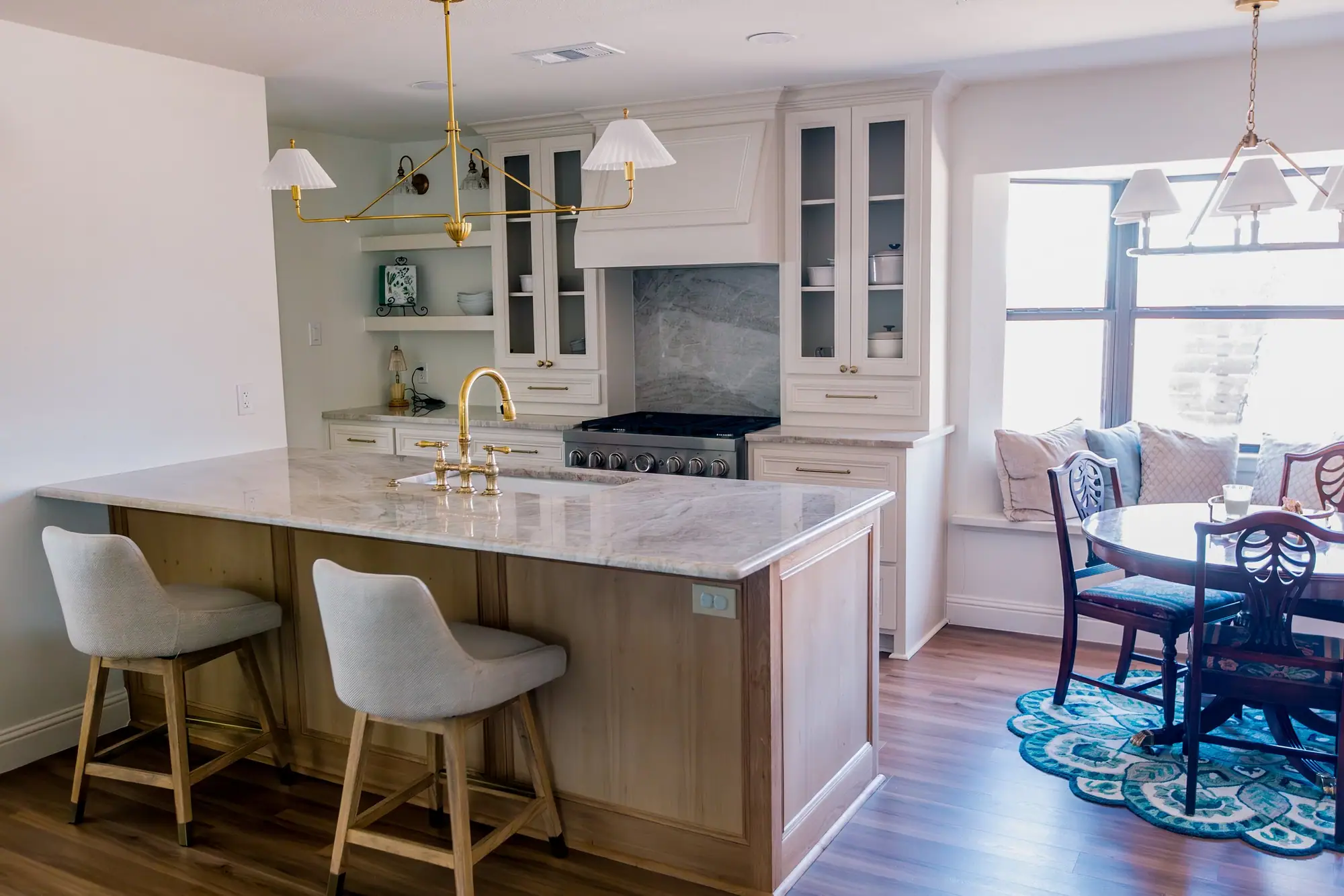
One of our projects here
Most houses here have enough space. The layout is usually what needs to change.
The median house here is 2,967 sq ft, and a quarter of them run past 3,594 sq ft. The rooms in a 1966 house are big. What feels dated is the floor plan, usually a kitchen closed off from the rest of the house.
Our work here
Three Overton Park houses we have remodeled.
We have remodeled three houses here. Houses from this period tend to have their walls and primary suites in the same places, so we know what we will find when we open them up. We have also seen how the soil changes from one block to the next.
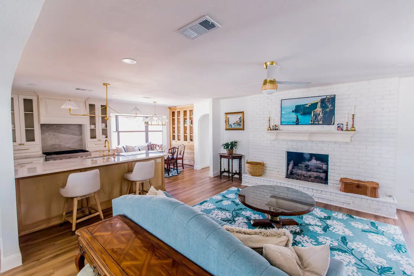
Whole home
A 1966 house with the walls opened up
We took out the walls between the rooms, and most of them turned out not to be holding anything up.
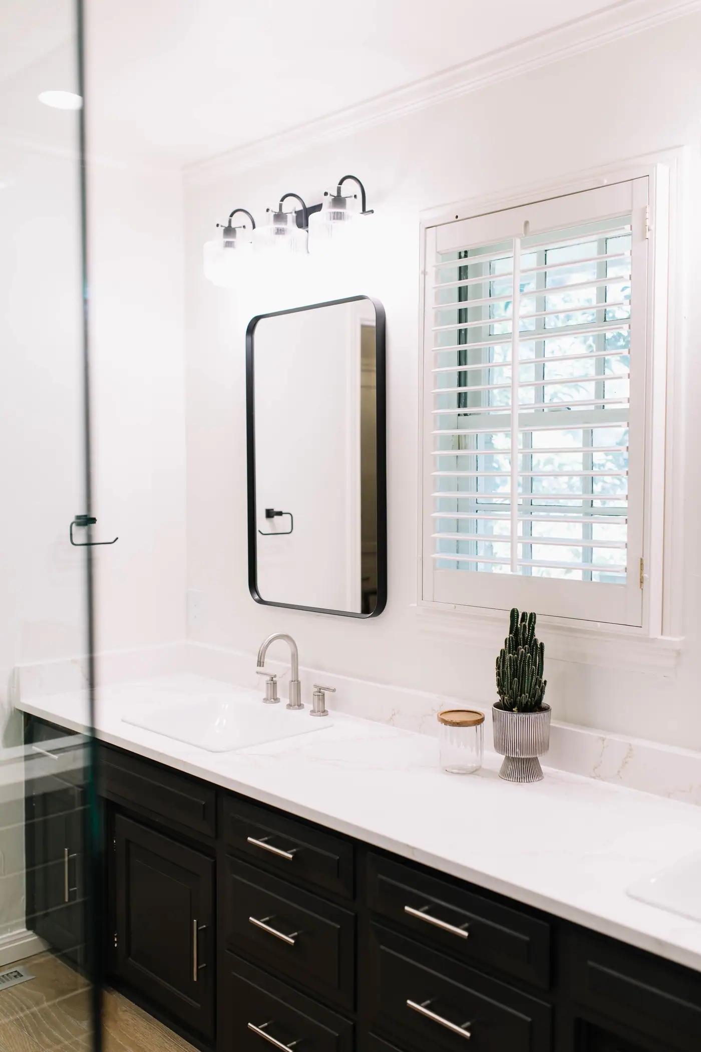
Primary bath
A larger primary bath, built inside the existing suite
We took the space for the new bath from a closet, a linen hall and a landing that were already part of the suite.
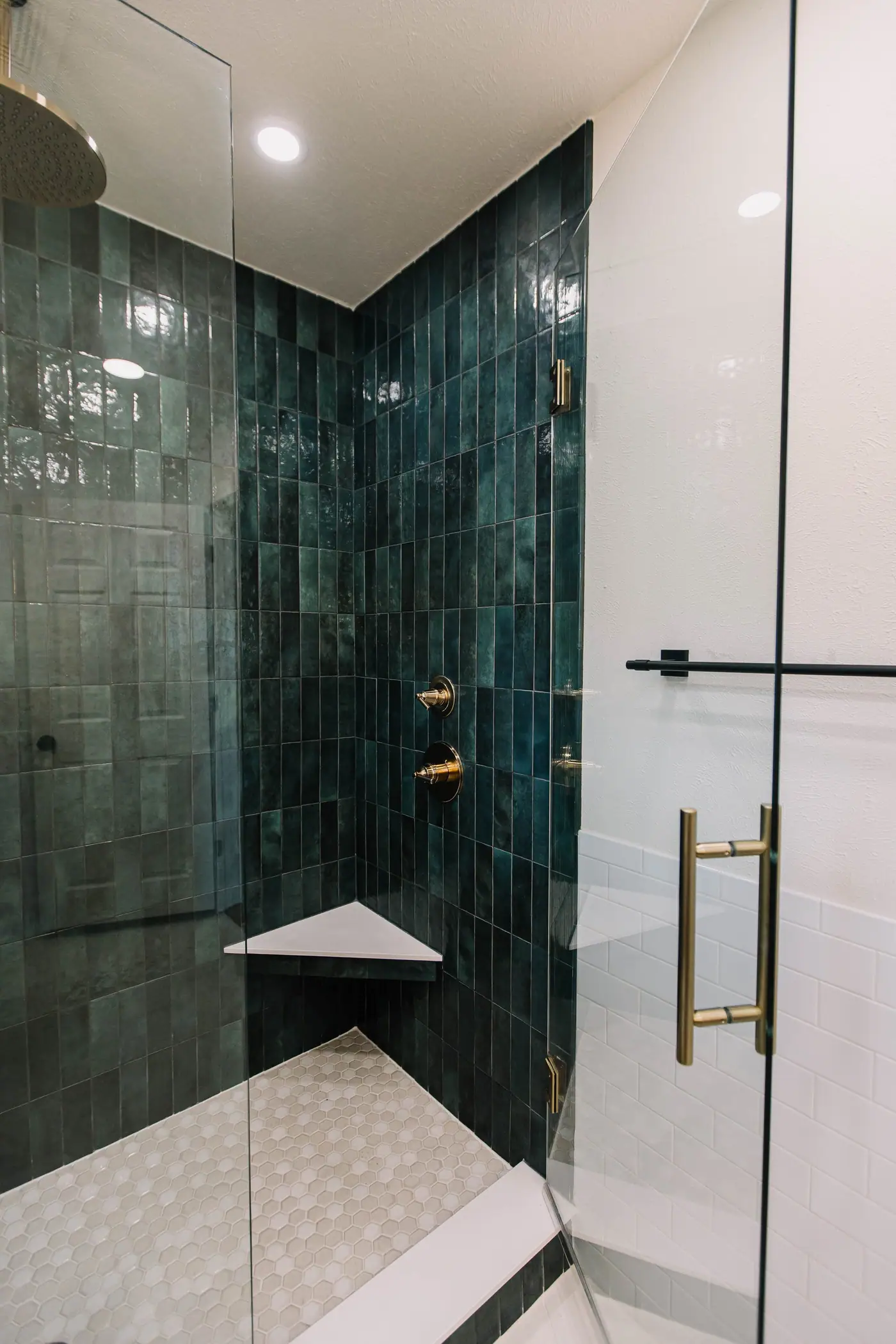
Bath and exterior
A secondary bath and a refreshed exterior
The secondary bath redone in walnut, brass and deep green glazed tile.
Best Home Builder & Remodeler
Fort Worth MagazineFort Worth Chamber Small Business of the Year4.7 stars from 91 Google reviews as of September 2026
Whole-home remodels in Overton Park
What a whole-home remodel involves in a 1966 Overton Park house, where the rooms are big but closed off from each other.
Go →Primary bath remodels in Overton Park
What a primary bath remodel looks like in these 1960s houses.
Go →The Tanglewood guide
The neighborhood just north, built by the same developer. Its elementary school lost half of its attendance zone in 2020.
Go →Questions people ask about Overton Park
Questions about remodeling, additions, schools and soil in Overton Park.
- Is a house in Overton Park worth remodeling, or is the lot worth more than the house?
- It depends on the house and the block, and we can price both before you decide. The lots here run about a third of an acre. Twelve of the 691 houses here record a build year of 2000 or later — the arithmetic is further up this page, and it is an appraisal record, not a permit record, so it is a proxy and not a count. It shows that few houses here have a recent build year. It cannot tell you about your block, so we price your house instead of assuming. We can price the remodel on a cost-plus basis, line by line, and our agents can tell you what the house is likely to bring as it stands and how buyers here have valued the change. We are a one-stop shop — designers, builders and a brokerage under one roof — so you get both numbers at the same time.
- Do I need historic approval or design review to remodel here?
- No. The City’s zoning map records no historic overlay anywhere in Overton Park, so there is no certificate of appropriateness step and no design review board. With no review board, the main check on how an addition looks is the street around it. Most houses here went up in the same building period at a similar size, so an addition that does not match will stand out. That makes the exterior design worth getting right, even though no board reviews it. Private deed restrictions are a separate matter from zoning and are worth confirming for your own block; we do not publish a description of them on this page, because nobody here has read the recorded instrument.
- How much can I add on a lot this size?
- More than most of Fort Worth allows on a typical lot, because the lots here run about a third of an acre. The exact number depends on your parcel. About two thirds of the neighborhood is zoned A-10 One-Family, which sets a 10,000 sq ft minimum lot, a 60 ft minimum width, 40% maximum lot coverage and a 25 ft front yard. Roughly a fifth is A-21 One-Family, where the minimum lot is 21,780 sq ft, the width 85 ft, the coverage 30% and the front yard 30 ft. Two houses a few doors apart can fall under different rules, and that changes how big a new wing or second story can be. On top of that, on a block face that is at least 40% built, Fort Worth measures your front yard against the neighboring houses rather than against the district minimum, up to a 50-foot maximum, so your required front yard may be deeper than the zoning table says. We look up the parcel before we draw anything.
- What schools does an Overton Park address feed?
- Overton Park Elementary (PK–5), then McLean 6th Grade Center (grade 6, and nothing else), then W. P. McLean Middle School (7–8), then R. L. Paschal High School (9–12). That covers every grade, pre-K through twelfth, from one address. We publish no rating for any of these campuses: no accountability grade with a named issuing body and a year was found. Boundaries also move, and the section above covers which campus zones this neighborhood — so check the district's own finder against your specific address before you write an offer.
- What is the ground like here?
- It varies from lot to lot. Sampled across the neighborhood the ground breaks into seven soil units — the reading at the center is a clay that both moves and sits on limestone within a foot or two, while most of the rest is a lower-movement profile. Two houses on the same street can sit on different soil, so a figure for the whole neighborhood cannot tell you what your foundation work will cost. We check the soil for your lot instead of assuming it matches the last job, and it is worth doing early if you are weighing a pool, an addition or anything that needs a new footing.
- Where does the extra square footage for a primary suite come from?
- Almost always from inside the footprint you already have. The median house here runs 2,967 sq ft and 1960s plans put nearly all of it into bedrooms. A typical suite of this era has a shallow closet, a linen hall and a bedroom next door that has become an office. Redesigning those rooms together is cheaper and faster than adding to the outside of the house, and it does not touch the roofline, the foundation or a single tree. These are slab-on-grade houses, so moving a drain means cutting into the concrete slab. That is normal work on houses of this age, and we include it in the schedule and the price.

Talk to us
Send us an address and we will come look at the house.
Send us an address on these streets and we will go and find out what it is worth as it stands, what your parcel actually allows, and what the change you are picturing would cost to build. You get all three answers from one company, before you have committed to anything.
Sources Verified September 2026. Houses, lots and every build-year figure, on both sides of the Tanglewood comparison: Tarrant Appraisal District parcels for tax year 2025, clipped to the City of Fort Worth’s own neighborhood-association boundary for Overton Park and measured with our own tooling in September 2026, and the same parcel set, the same boundary layer and the same tax year, read for Tanglewood on the same day — the City’s neighborhood-association outline, which it publishes as a map image and not as a surveyed line, and parcels that straddle a boundary are excluded on both sides of the comparison, so each count runs a little low — and on this side the edge being dropped is the one abutting Tanglewood, which is where a rebuild is likeliest. Assessed values for a specific house: Tarrant Appraisal District. Zoning districts and their standards: the Fort Worth Zoning Ordinance on American Legal Publishing, the platform the City’s own zoning page designates as the ordinance of record — § 4.703 (A-10), § 4.702 (A-21) and § 6.101 (yards); zoning shares are point-sampled from the City’s zoning layer and are accurate to about a point, which is why they are written as fractions and not as percentages. The park, the greenbelt and every tree figure: the City of Fort Worth’s Overton Park and Foster Park pages and its Overton & Foster Park Master Plan, whose tree section was written by an advisory botanist. The school run: FWISD’s School Finder run against two addresses inside the neighborhood for the 2026/27 boundaries, and the district’s own “What is after Overton Park?” page — Fort Worth ISD’s own feeder page and Fort Worth ISD. The ranch, the 640-acre grant of 1848, Caswell Overton Edwards born in 1851, development from the mid-1950s and cattle on this ground until 1954: the Overton Park Neighborhood Association and a Fort Worth history of the Edwards family, which disagree on two dates — the better-documented ones are published and no single Cassco year is. The ground: USDA NRCS Soil Data Access, sampled across the neighborhood and queried in August 2026, so that one is an August reading under a September band. No median price, price per square foot or days on market appears on this page — the real estate sites update those nightly, and a figure written into this page would quickly go out of date.