
Fort Worth · 76110
Living in Mistletoe Heights, Fort Worth
Rather talk it through? Call or text (817) 631-9803
Most of its roughly 400 houses went up in the 1910s and 1920s, on the bluffs above the Clear Fork.
Rather talk it through? Call or text (817) 631-9803
Where it is
Mistletoe Heights sits between Rosedale Street and Park Place Avenue, southwest of downtown.
- 1Lily B. Clayton Elementary
- 2Newby Park
Mistletoe Heights covers about 173 acres in ZIP code 76110. The City of Fort Worth registers West Rosedale Street as its north edge, Park Place Avenue as its south edge and the railroad tracks as its east edge. Its west edge sits above the Clear Fork, where the ground falls away toward the river.
- North
- “Rosedale”
- South
- “Park Place”
- East
- “Santa Fe Railroad Tracks”
- West
- “Mistletoe Drive”
As the city’s registration for the Mistletoe Heights Neighborhood Association lists them.
Inside the line
-
Lily B. Clayton Elementary. It opened in February 1922 as Mistletoe Heights Elementary, with 79 students and three teachers, and has been a city landmark since 1990. Its grades and the state’s 2026 ratings are under The school, below.
-
Newby Park. 2.75 acres with a playground, a ball field, a basketball court and a pavilion, open dawn to dusk. The city calls it possibly the first integrated park established in Fort Worth; the story is in the questions below.
At the edge
Forest Park. The city park’s land meets the neighborhood’s line.
Road miles, measured from Newby Park
- Baylor Scott & White All Saints 0.5 mi
- Fort Worth Botanic Garden 1.5 mi
- Fort Worth Zoo 2.0 mi
- TCU 2.5 mi
- Downtown Fort Worth 2.5 mi
- The Shops at Clearfork 3.5 mi
The houses
Most houses in Mistletoe Heights were built between 1910 and 1929.
One square for each of the 409 houses
- 1910s · 148
- 1920s · 156
- Other decades · 82
- 2000 and later · 23
Of the 409 houses inside the city’s line, the appraisal district records 148 built in the 1910s and 156 in the 1920s, and the median build year is 1922. Four in five date from before 1941. Only 23 carry a build year from 2000 on.
The deed restrictions, as the neighborhood association records them, set a minimum cost of $5,000 for a house and banned frame construction. The same restrictions barred selling homes to minorities, a provision that is illegal today.
A build year is when a house was first built. A renovation, even a full one, doesn’t change it, so ask what a house has had done since.
The school
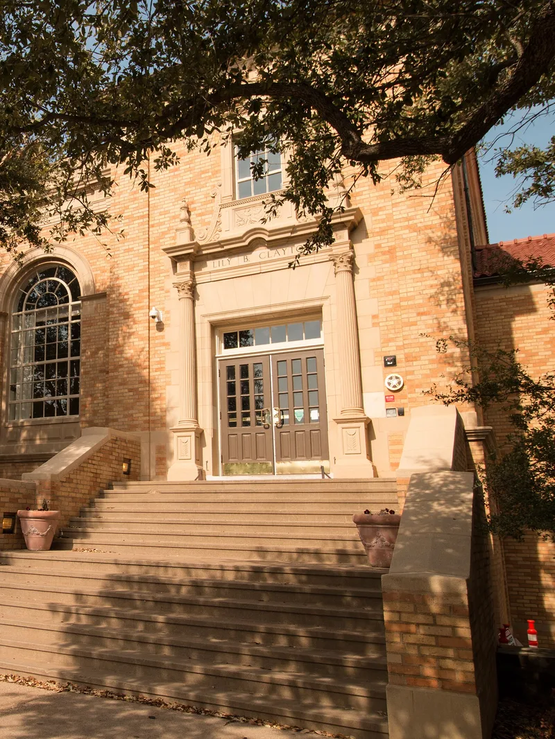
Lily B. Clayton Elementary sits inside Mistletoe Heights, at its south edge.
Lily B. Clayton Elementary is a Fort Worth ISD school for pre-K through fifth grade. It belongs to the district’s Paschal feeder pyramid, which lists McLean 6th Grade, McLean Middle, Daggett Middle and Paschal High School.
Fort Worth ISD assigns schools by street address. Before you make an offer, enter the house in the district’s School Finder to see which schools it is zoned to.
.jpg)
The Paschal feeder: Texas Education Agency ratings, 2026
Lily B. Clayton Elementary
PreK–5
B86/100
Which middle school depends on the address.
McLean 6th Grade
6
C76/100
McLean Middle
7–8
B88/100
Daggett Middle
6–8
C75/100
Paschal High
9–12
B87/100
Lily B. Clayton Elementary
PreK–5
B86/100
Which middle school depends on the address.
McLean 6th Grade
6
C76/100
McLean Middle
7–8
B88/100
Daggett Middle
6–8
C75/100
Paschal High
9–12
B87/100
The lots
The median lot in Mistletoe Heights is about 58 feet wide.
Measured from the city’s parcel map, the median lot here is about 58 feet across and 135 feet deep, with a recorded area of about 7,750 square feet. Half the lots are between 50 and 67 feet wide, and six in ten are 60 feet wide or less. A-5, the zoning on most of the land here, sets 50 feet as its minimum width.
For comparison, the same measurement puts the median lot at about 50 feet wide in Arlington Heights and about 104 in Ridglea Hills.
On a lot this narrow, an addition usually goes off the back of the house. Home additions in Mistletoe Heights covers where an addition can go. The Fort Worth price range for additions follows the district section.

The historic district
About five in six houses here sit inside the city’s historic district.
Fort Worth designated the Mistletoe Heights Historic and Cultural District in 2002. Of the 409 houses inside the neighborhood’s line, 341 sit inside the district on the city’s map, and 6 more just outside its mapped line carry a historic overlay on the city’s zoning map. The district’s line crosses some streets, so one street can have houses on both sides of it.
A listing usually won’t say which side of the line a house is on, and that side decides what you can change on the outside.
347
Houses with the overlay
341 in the shaded district, 6 just outside it
“Any changes to the exterior of historic properties require a Certificate of Appropriateness before obtaining permits or beginning construction.”
For houses inside the district, its guidelines say review “will focus on the front facade and sides,” that an addition goes “at the rear or side,” and that nothing new may be more than 35 feet tall. They “shall not apply” to the inside of a house.
62
Houses without it
The city’s regular permit process applies, with no design review. One of these houses carries a demolition delay instead, which adds a review only before it is torn down or moved. Base zoning and building codes are the same on both sides of the line.

To check a house, look up its address on the city’s zoning map, or send it to us and we’ll look it up for you.
Home additions in Fort Worth
$60,000–$420,000
a bump-out at the low end, a full second story at the top.
Ranges for a home addition in Fort Worth, not a quote. Before there are drawings, a range is the only honest number anyone can give you — the spread between a high and a low bid on the same job is routinely 20% or more. We bill cost-plus, so when there is a plan you see the actual materials, labor and subcontractor costs, plus our overhead and profit, rather than a single figure with the unknowns padded into it.
What changes the price
- Which kind of addition. A bump-out borrows the roof and structure you already have; a second story needs engineering, a staircase, a new roofline and every system re-integrated.
- Whether a bathroom is in it. Plumbing into new square footage is $15,000–$35,000 on its own, and how far it sits from existing lines decides where in that band you land.
- What the existing house can carry. Whether the foundation extends, whether a bearing wall is in the way, and whether the framing can take a floor above it are answers that come from opening things up, not from the curb.
- Matching the character. In the neighborhoods with a historic overlay — Ryan Place and Mistletoe Heights among them — custom millwork and matched exterior materials add 10–15%.
- Per square foot
- $175–$400
- How long it takes
- 3–9 months
- Fort Worth permit fees
- $1,200–$3,500
- Set aside a contingency
- 15–20% of budgetfor what the existing house turns out to be hiding
The bluff
The ground falls about 60 feet at the west edge, toward the Clear Fork.
We sampled the ground at 277 evenly spaced points inside the city’s line, using the U.S. Geological Survey’s elevation data. Eight in ten of them fall between 588 and 629 feet above sea level, around a middle height of 613. The lowest, 550 feet, is at the west edge, where the land drops toward the river.
None of the 409 house lots has its center inside the flood zone FEMA maps for a 1-in-100 chance of flooding in any year, and 3 touch its edge. A lender looks at where the house itself sits on FEMA’s map, so look up the parcel on that map before you make an offer.
Middle heightLowest pointFeet above sea level
Our work here
Four of our projects in Mistletoe Heights.
Our design team drew all four and our construction team built them. On the whole-home remodel, our brokerage handled the home transaction too.
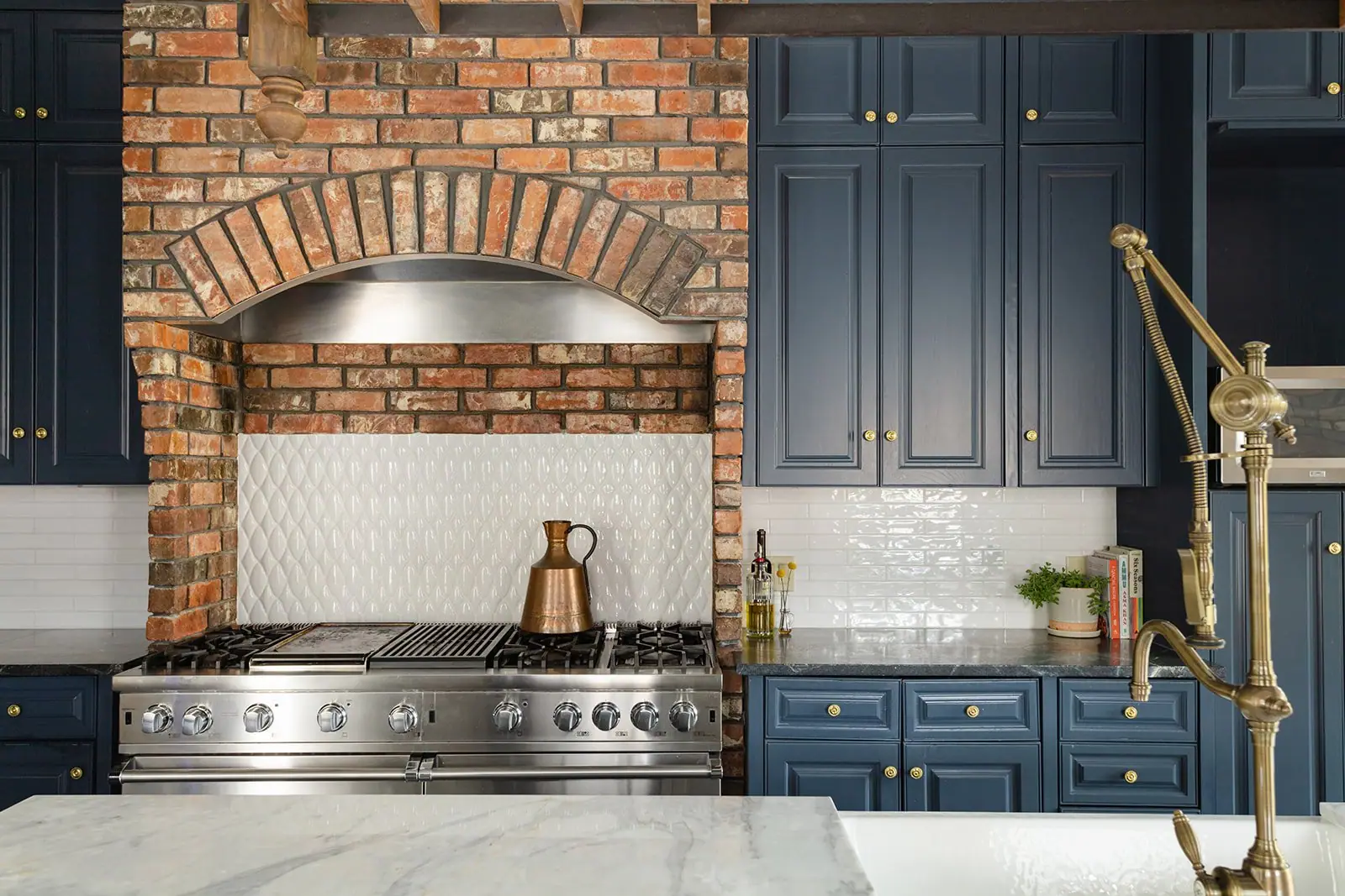
Whole-home remodel
Mistletoe Heights Whole-Home Remodel
We kept and painted the kitchen and bath cabinets, and new windows and doors on the back brought the house back to its original architecture.
Brokerage, design and construction
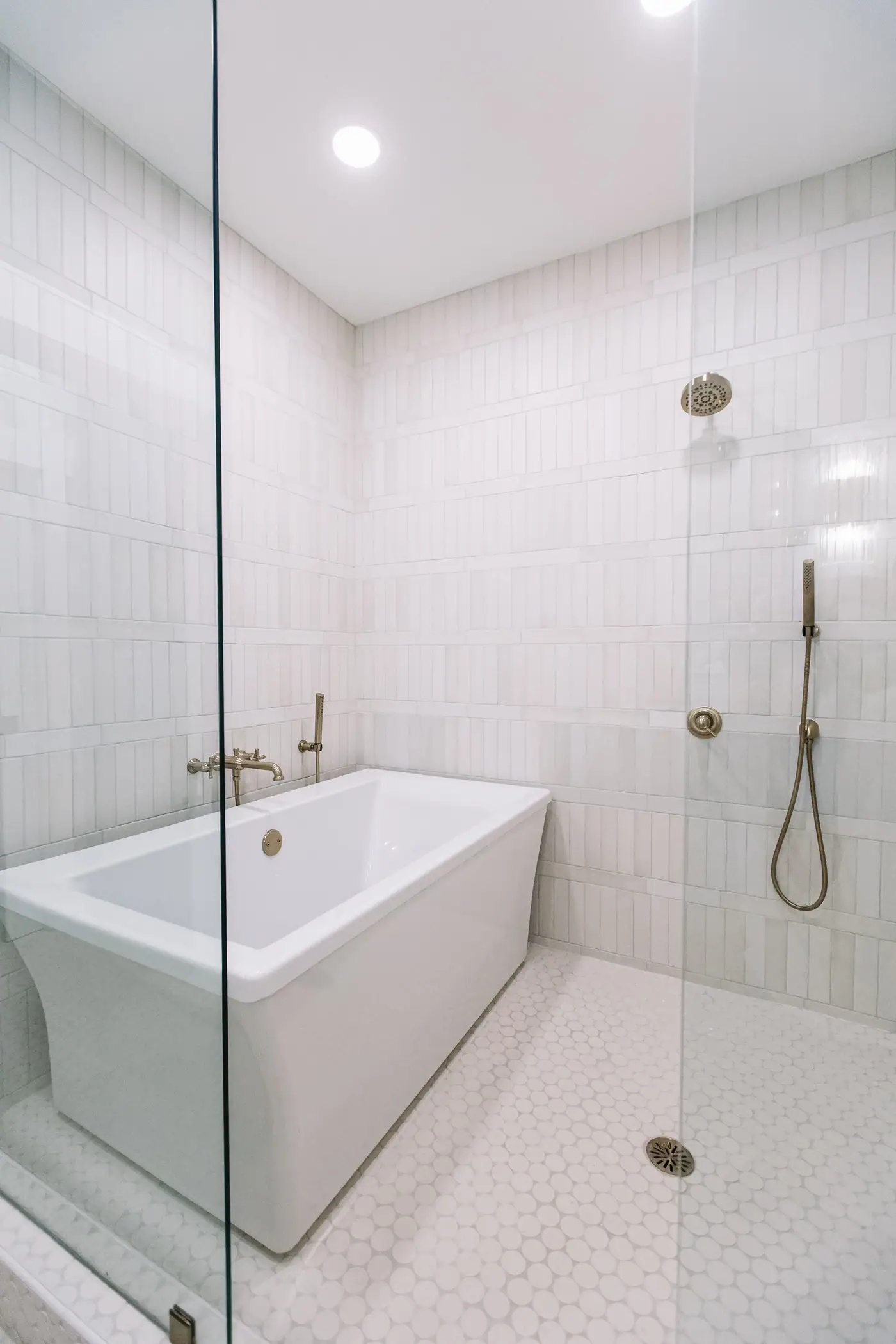
Kitchen and primary suite addition
Mistletoe Heights Kitchen & Primary Expansion
We started the design over, expanded the footprint for a larger kitchen, and added a primary suite and a back deck.
Design and construction
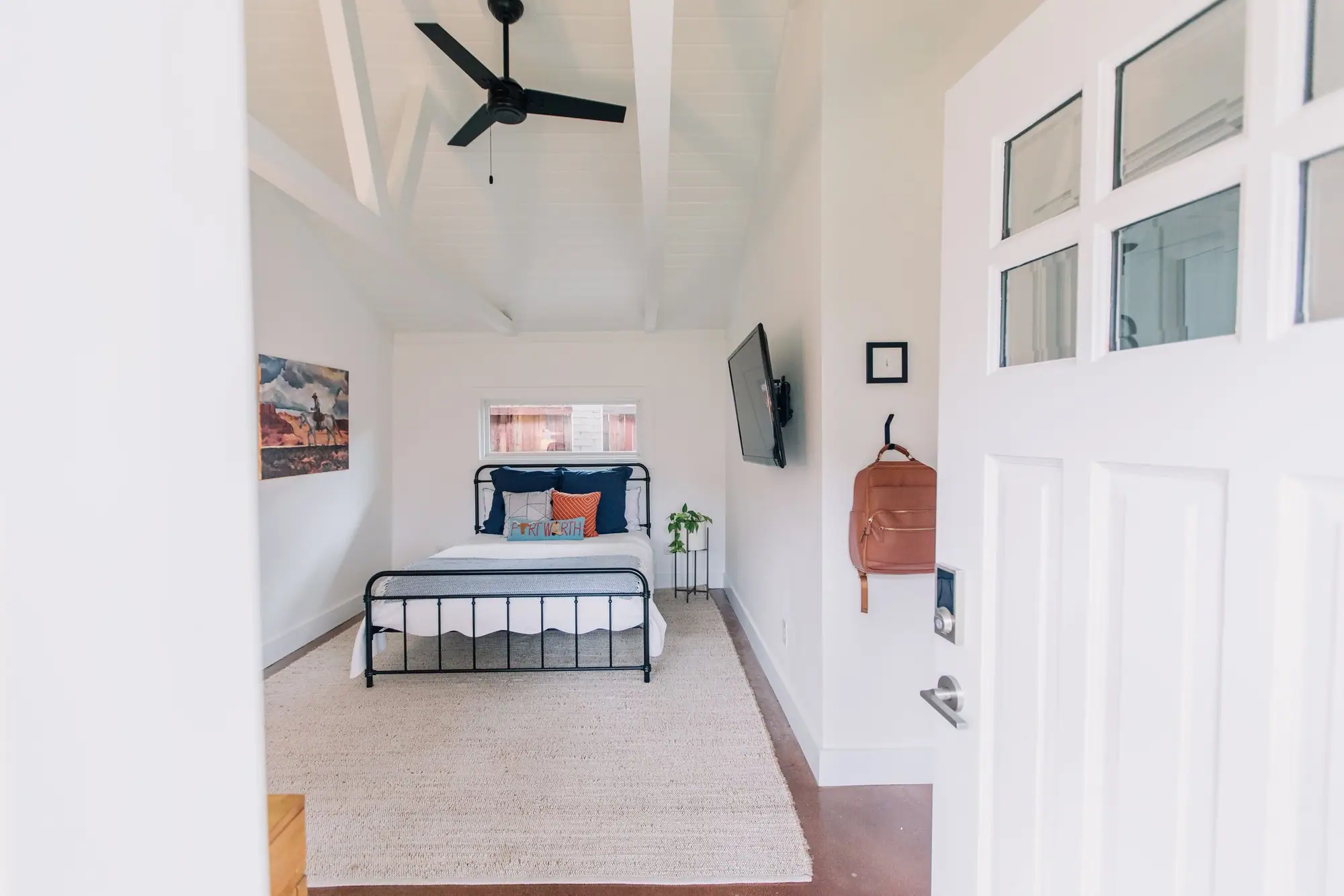
Garage conversion
Mistletoe Heights Garage Conversion ADU
A garage turned into a home office and guest house, with a new bathroom and a tongue-and-groove ceiling.
Design and construction
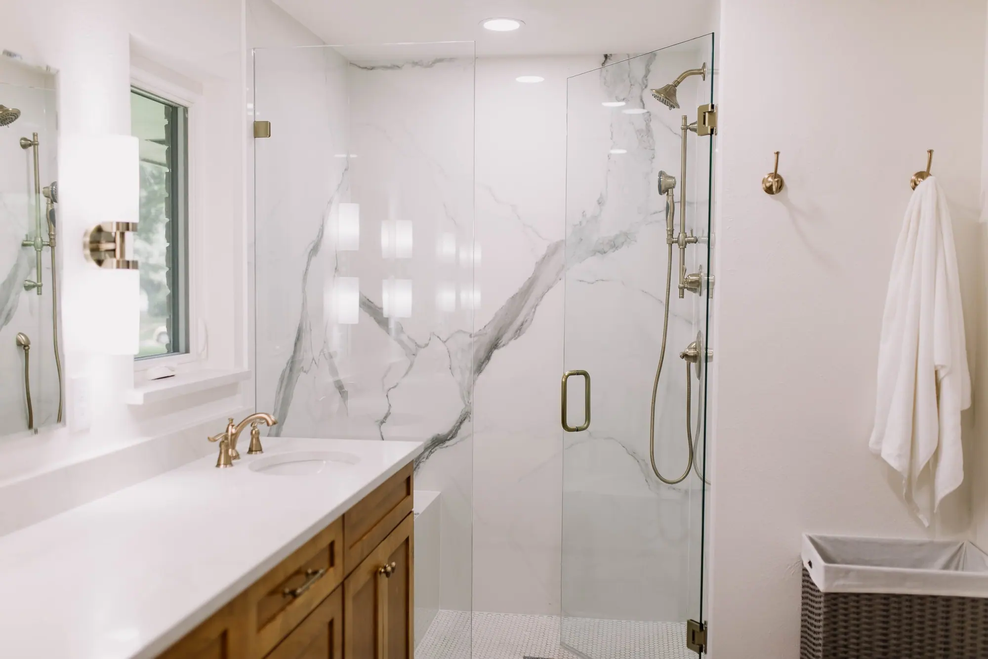
Primary bath remodel
Mistletoe Heights Primary Bath Remodel
Both baths gutted and rebuilt. The shower walls are a single sheet of porcelain.
Design and construction
Best Home Builder & Remodeler
Fort Worth MagazineFort Worth Chamber Small Business of the Year4.7 stars from 91 Google reviews as of September 2026
Questions
Questions about Mistletoe Heights: Newby Park, the school, the association and the district line.
What is Mistletoe Heights known for?
Mistletoe Heights is known for its houses from the 1910s and 1920s, on the bluffs above the Clear Fork of the Trinity River, southwest of downtown. Inside the line Fort Worth draws for it are Lily B. Clayton Elementary, which opened in 1922 under the neighborhood’s name, and Newby Park, which the city calls possibly its first integrated park. Forest Park meets its edge. Most of its houses also sit inside a city historic district.
Which schools serve Mistletoe Heights?
Fort Worth ISD assigns them by street address. Lily B. Clayton Elementary, for pre-K through fifth grade, is inside the neighborhood and belongs to the Paschal pyramid, which also lists McLean 6th Grade, McLean Middle, Daggett Middle and Paschal High School. In the Texas Education Agency’s 2026 ratings, Clayton received a B, with 86 of 100. Enter any house in the district’s School Finder to see which schools it is zoned to.
Is Newby Park the first integrated park in Fort Worth?
Possibly; that is the city’s own word for it. In 1949 the city leased the land from the Etta Newby trust for one dollar a year, after 111 residents of the nearby streets signed a petition saying they did not object to the park being used by both white and Black residents. It became a city park in 1951, and a pavilion was added in 2005 through the efforts of the Friends of Newby Park.
Does the historic district cover all of Mistletoe Heights?
No. On the city’s zoning map, 347 of the 409 houses inside the neighborhood’s line carry a historic overlay: 341 inside the district and 6 just outside its mapped line. Of the other 62, one carries a demolition delay and 61 carry no overlay. The line crosses some streets, so the neighborhood’s name doesn’t settle it. With the overlay, a change to the outside of a house, an addition included, needs the city’s sign-off first, called a Certificate of Appropriateness. The district’s guidelines don’t apply to the inside. Look up the address on the city’s zoning map to see which side it is on.
Why did Fort Worth stop work on a new house in Mistletoe Heights?
Because its front wall sat closer to the street than the code allowed. The Fort Worth Report wrote in May 2026 that the city stopped work in November 2025, after the framing went up, on a house about 35 feet from the street where the neighboring house set the line at 47. City code, as the Report put it, requires a new house in an established neighborhood to sit at least as far back as the neighboring house with the smallest setback. The lot was in the part of the neighborhood that opted out of the historic district, so no historic review saw the plans. The Board of Adjustment granted a variance in January 2026, and the city said it was making stakeout inspections, a check of the foundation’s corners before the pour, mandatory. The city’s setback rule applied all the same.
Is there a neighborhood association, and do I have to join?
There is, and membership is voluntary, according to the city’s registration for the Mistletoe Heights Neighborhood Association. It holds general meetings every quarter and publishes a newsletter, the Mistletoe Heights Express. Joining is separate from the district: the district’s rules apply to a house inside it whether or not its owner is a member.
Your next step
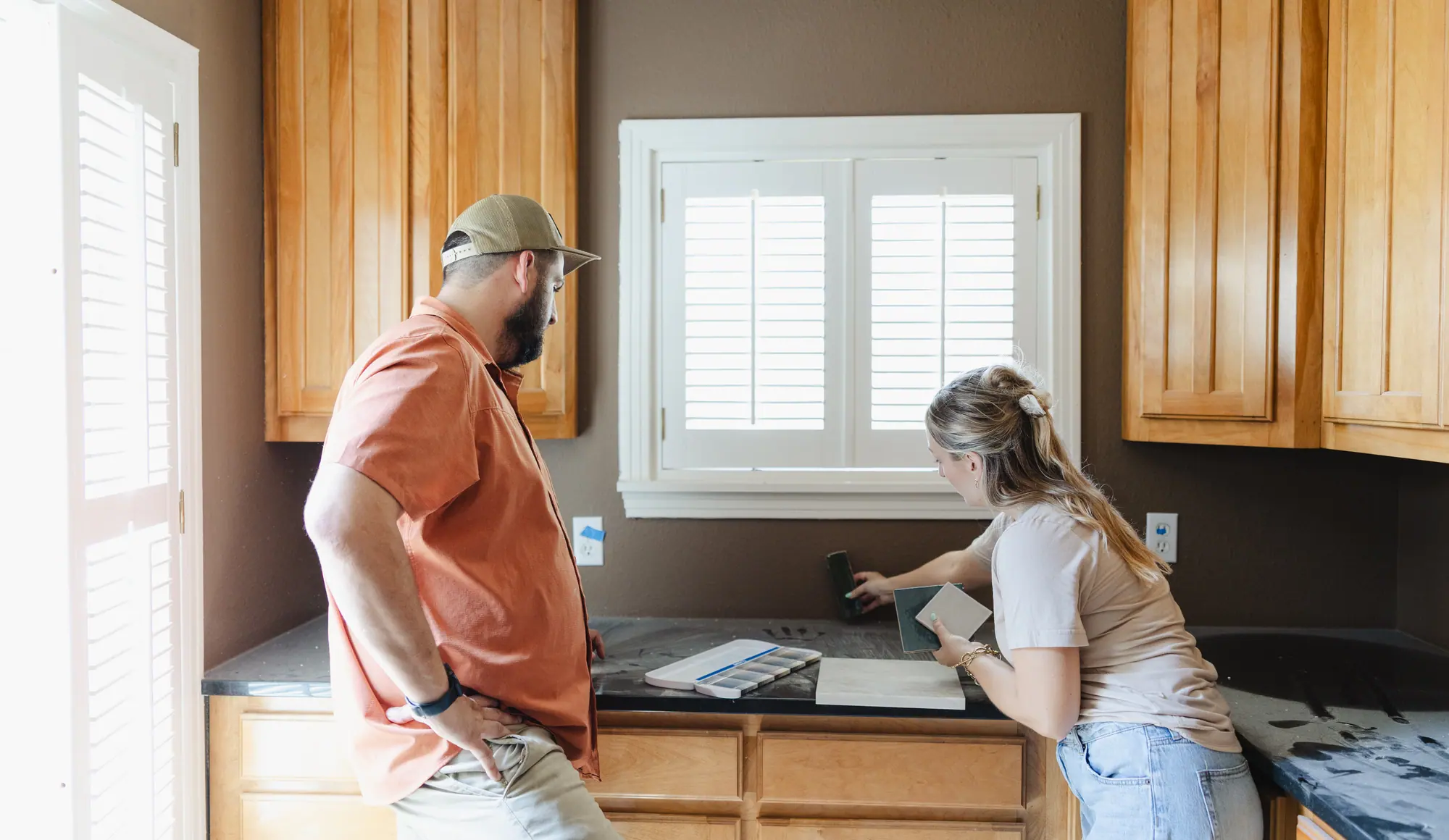
Find out what a Mistletoe Heights house is worth, and what it would cost to change.
- 1 Share a listing you’re considering, or the house you already own.
- 2 We check the address: the lot, the flood map, the schools it’s zoned to and the district line.
- 3 You hear what the house would sell for from our real estate agents, and what the changes you want would cost from our designers and builders.
If you’re buying, get all four answers, the district line included, before your option period ends. Once it closes, you can’t walk away just because you changed your mind.
On a narrow lot or inside the district, we’ll tell you what you can change on a house before you commit to it.
Rather talk it through? Call or text (817) 631-9803
Sources
Verified October 2026. Boundary: the City of Fort Worth’s registration for the Mistletoe Heights Neighborhood Association and the association’s outline in the city’s GIS. Houses, build years and lot sizes: Tarrant Appraisal District parcels (tax year 2026) as the city’s GIS publishes them, read on October 18, 2026. “Houses” are single-family parcels wholly inside the city’s line. Historic district and overlay: the city’s district and zoning map layers, the city’s Historic Preservation page and the district’s Historic and Cultural District Guidelines. Schools: Fort Worth ISD’s school list and the Texas Education Agency’s 2026 accountability ratings. Newby Park and Forest Park: the city’s parks pages and parks map layer. Ground height: U.S. Geological Survey elevation data. Floodplain: FEMA’s National Flood Hazard Layer. Distances: driving routes on OpenStreetMap data, rounded to the half mile. History and the deed restrictions: the Mistletoe Heights Neighborhood Association. The Clear Fork: the U.S. Geological Survey’s National Hydrography Dataset. The rail line on the map: © OpenStreetMap contributors. School photo: Renelibrary on Wikimedia Commons, CC BY-SA 4.0. The 2025 stopped build: the Fort Worth Report, May 12, 2026.